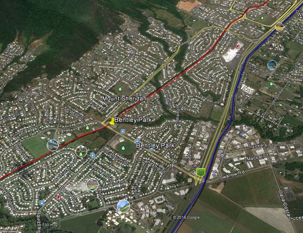
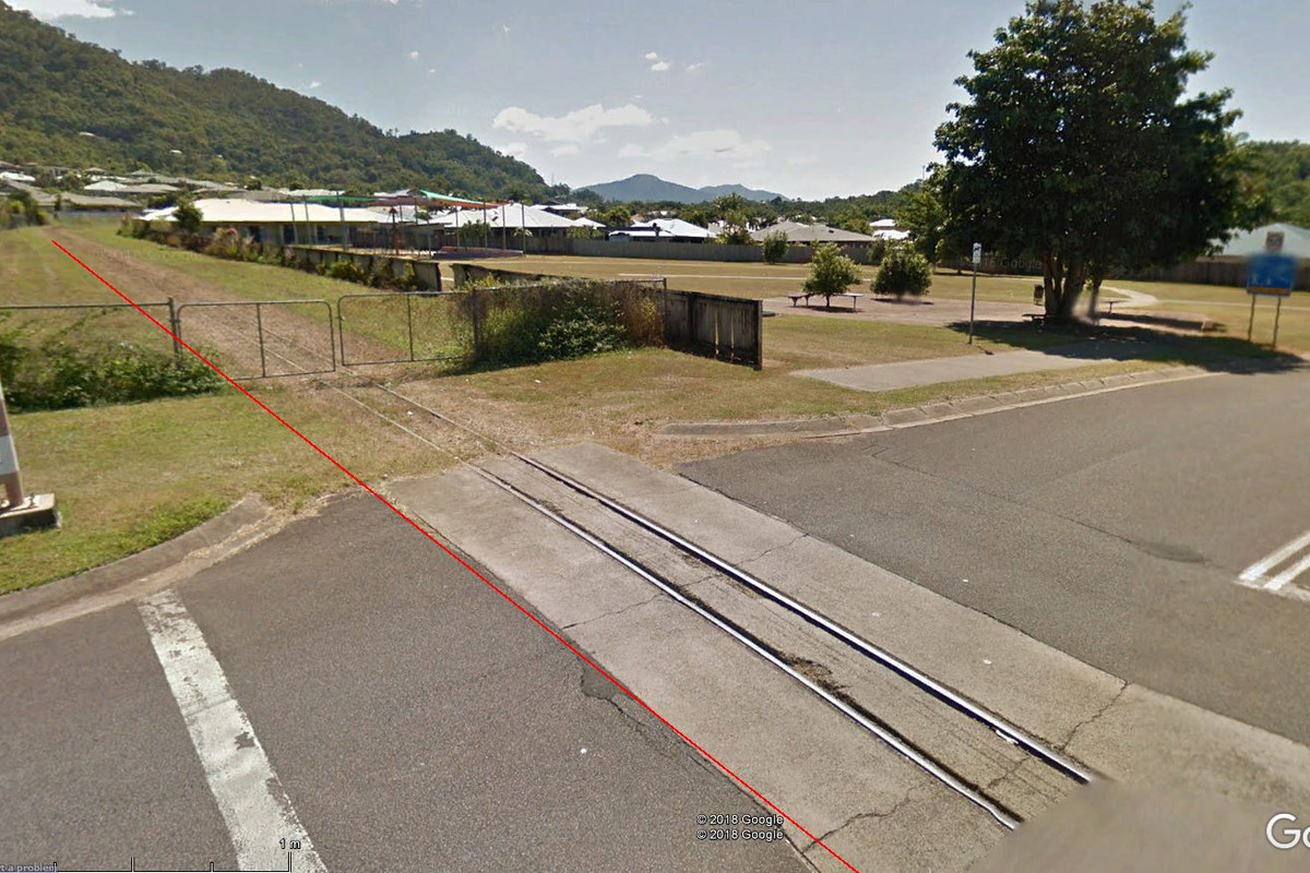
Browsing Open Street Map around Cairns (as you do), in addition to the well known Kuranda line I noticed there is what appears to be a narrow gauge line from Kanimbla to Bentley Park, on the western side of the city. Further investigation revealed this at one time appeared to extend out to Gordonvale and part of a larger Network. Google Street View confirmed 2ft gauge.
However at that point I drew a blank. I'm assuming it's an old sugar cane line but can't find any information on line - Google Fu just spams page after page of the Kuranda tourist train. The tracks look shiny in Street View but in that case you would have thought someone, somewhere would have some info on the web.
Always on the lookouut for quirky ng prototypes, can anyone advise a bit more about this line or point to some links?
Last edited: