TranzDEM Baseboard Trimming

csx6900

New member
Hi everyone,

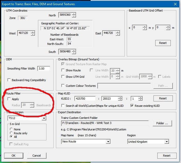
I am currently trying to create a DEM route in TS12 using TranzDEM. The route I am creating runs in a northeasterly direction, which means that the route in diagonal. Since TranzDEM only exports maps as rectangles, this leaves a few thousand extra baseboards that I don't need in the corners. How can I force TransDEM to cut off the extra baseboards, perhaps by telling it to only export the baseboards along the raster map? Or, is there a way to delete baseboards in mass in Surveyor?

Please let me know if you need more information, and thanks in advance!

-Evan Lofback
Knoxville, TN
 
You have to be careful which tiles you delete, as it may take a huge chunk out of your map ... sometimes it is best to rough out the edges using Transdem ... then finish up deleting individual baseboards in surveyor, one by one is all that Trainz does.
 
G'day csx6900,

...the easiest way to 'reduce' the size of your route (in a most systematic method) with TransDEM, Evan, is to utilise the "Route Filter" option in the export dialogue box. To do this, you must provide a "route polyline" using the "Simple Route Editor" tool and setting the aforementioned filter to the desired number of baseboards you wish to retain around the route polyline. The default is three but it can be set to a minimum of 1 and a maximum of eight...

Jerker {:)}
 
Please explain in detail, exactly how to trim down Transdem baseboards ... as a DEM is way too big to import into Trainz

The person that I am trying to assist has some "special needs" and he has mastered much of Transdem ... But he needs 1 on 1 assistance, like via PM or via Free Skype, how to whittle down a huge DEM

Someone please try to assist him: MNIBARI08

From reading the manual, and Forum responses, the baseboard trimming process, and the whole Transdem manual, seems a bit vague, and difficult to understand by "special needs" persons

From what I understand the "polyline" is the track drawing tracing line you lay down, highlighting the rail line ... having that polyline hand drawn ... where is the "Delete" button ... if you set the to route editor is set to retain 1 squares ?

=================================

One response was:
Firstly, you switch on the baseboard grid in TransDEM.

Then you position the export mask edge where you want to cut. Compare mask and baseboard grid. Only those baseboards will be included in the export which reside entirely in the interior of the mask. Take a mental note of where you cut. (You can also look up this later, in the TransDEM info file, a text file that TransDEM generates alongside the route. It has the border coordinates as UTM values.) Export the mask range.

For the second section, reposition the mask. Make sure that there is neither a gap nor any overlapping in the baseboards designated for export, compared with the first section. Carefully adjust the mask to achieve this.

You can also fine-tune in the export dialog itself, using the numeric controls for the north/south/east/west borders.

Import both modules with Content Manager and merge in Surveyor.

Try this with a small route first, to gain some hands-on experience.

==========================================

Surely many hundreds and hundreds of people have purchased Transdem, and hundreds of people can not understand exactly what the manual is saying, and they can not master Transdem ... and simply delete the Transdem program, and simply chalk it off as a lost cause, as a much too complex program, that has very vague instructions
 
Last edited:
I suggest to try the recent Seamless Merge tutorial. While focusing on a slightly different task, it also comprises nearly all the steps for splitting a route into sections and reassembling it in Surveyor.

If any questions remain, re-read my earlier reply, quoted in the post above. When some of my hints do not appear to make sense, even after successfully completing the Seamless Merge tutorial, point them out to me.
 
Looks like "Rockit Science" to me ... the videos are much too fast (your changing the channels way to fast wienerdawg) ... the manual is much too entailed, with hundreds of thousands of words to read, thousands of technical settings box's, where you have to enter in thousands of numerals and characters ... seems sort of like a 4 year college course in cartography to me.

Can't someone design a simple program that has a stretchable bounding box, zoom in on England, cut, copy, paste, trim, export, import ... way too technical wienerdawg !
 
G'day cascaderailroad,

I say, "cascaderailroad", that's a bit 'rough' referring to "The Good Doctor" as ..."...wienerdawg..."... If I were "geophil", I would demand an apology...

...I have just made an offer to help MNIBARI08 out via PM (he contacted me directly), possibly using SKYPE (if suitable arrangements can be made), so we shall see how things "pan out"...

Jerker {:)}
 
Last edited:
Surely many hundreds and hundreds of people have purchased Transdem, and hundreds of people can not understand exactly what the manual is saying, and they can not master Transdem ... and simply delete the Transdem program, and simply chalk it off as a lost cause, as a much too complex program, that has very vague instructions

I have no knowledge of how many "hundreds and hundreds of people" have done as you claim but I can state that the manuals provided with TransDEM and TrainzDEM are not any more difficult to master than some others that I have used - converting from Adobe Fireworks to GIMP was a recent battle that I think I have "won".

Sure, there is a lot of terminology and many many program settings but I have found that the information you need is all there in the manuals. The tutorials have been particularly helpful. I think Roland has done a very good job. Over the last 20+ years I have written 9 textbooks, all on computer science, and I know how difficult it can be to explain technical subjects in a form that all readers will be able to understand. It is even more difficult to write when your audience consists of both experts and novices. You either bore the former group or leave the latter bewildered. Perhaps you are looking for an "Idiots Guide to TransDEM" which will cover the whole topic in a much more superficial way?

My approach to TransDEM has been very piecemeal. I read, practice and use the sections that I need at that time and make lots of mistakes (sorry, "learning experiences") along the way. In no way would I attempt to digest the entire program in a single "gulp". While I have had the program sitting on the HDs of my various systems for several years now, I have only started using it this year. I still have a lot to learn.

It just takes perseverance and lots of practice - like learning Blender which I have yet to master at even a rudimentary level.

Peter.
 
G'day cascaderailroad,

I say, "cascaderailroad", that's a bit 'rough' referring to "The Good Doctor" as ..."...wienerdawg..."... If I were "geophil", I would demand an apology...

...I have just made an offer to help MNIBARI08 out via PM (he contacted me directly), possibly using SKYPE (if suitable arrangements can be made), so we shall see how things "pan out"...

Jerker {:)}
"Wienerdawg" I was referring to is Norms dog (on the TV show) where the dog was standing on the TV remote control, on the couch, and the channels were flipping so fast that it was a FF blur slideshow ... and Norm shouted to the dog: "Whoa, Whoa, Much too fast wienerdog" !

An "Idiots Guide to Transdem" is exactly what I am looking for. As simply drawing a stretchable bounding box, zooming in on England, cut, copy, paste, trim, export, import, would be much more simple ... why does one need all those hundreds of drop down input box's, that need input typed in all those numerals and characters ?

I bore easily when reading paragraph after run on paragraph, after a few sentences the "wurds" just become a jargon of mumbly jumbly, blah, blah, blah like Charlie Browns school teacher ... I think I have some sort of brain disability where my mind turns to moosh when overwhelmed with billions and billions of highly over techhnical facts and figures ... then my eyes begin to close, I fall asleep ... and eventually fall out of my chair crashing to the floor.

How hard does it really have to be to: draw a stretchable bounding box, zoom in on England, cut, copy, paste, trim, export, import a map into Trainz ? ? ?

Does it really need to be so complex, like NASA and the astronauts: " That's a roger Houston, METU was successful, altitude downrange 259,000 feet, MECO is affirmative, prepare for engagement of the separation of the SSRB from the CM" ?

TrainzForDummies.png
 
Last edited:
"Wienerdawg" I was referring to is Norms dog (on the TV show)

Which probably means zero to anyone outside of the US so could have easily been and was taken the wrong way.
 
I don't pretend to understand the more complex functions of Transdem but the basic functionality is so easy that, with respect, if you don't "get it" you probably have no business building routes in the first place!

As noted earlier, controlled tile extraction is simple. Ensure you have traced the course of the route on the overlaid mapping. Ensure the route filter is checked "on" and set the number of surrounding baseboards to 6 or 7, this should ensure on a diagonal route the "zig-zag" world boundary is beyond the maximum viewing distance. If you're worried about file size, extract terrain around the route to 5m and the rest as 10m resolution.

If, once working in the route you find there are still too many tiles or they are not visible from the railway being built, then carefully prune with the built in terrain delete tool.

And the zig-zag on a diagonal route is not the fault of Transdem but a legacy function of how Auran later N3V chose to depict the "world" and goes back to the programme's model railway origins. In an ideal world TANE would have given us a new structure which drew a smooth world edge parallel to the actual route, but it didn't. And even MSTS and TS20xx work on the basis of square tiles to build the world around a route.
 
Perhaps its that the original DEM was obtained from another external DEM source ? And was imported into Transdem. This guy has all the basics down of Transdem, but he can not get the baseboards to trim down the DEM size to 6 or 7 grids away from the traced railway line. Somehow I believe he is missing something basically simple, like an unticked input box
 
It means how many boards you have on either side of the route so if you wanted 5 boards either side of the track, you enter 5 and put a tick in the box, then your map will only include the route and 5 boards either side.
 
Back
Top