As promised, here is the route map for the Augsburg & Concord Railroad. The track is 95% laid. Industries are located at their "final" locations. The map does not indicate, but there are numerous passing sidings to permit two way traffic. While normally, maps are displayed with North to the top, I chose to rotate mine 90 degrees, to allow larger images.
After a couple of driving sessions from one end to the other and back to make sure everything is connected; I will start planning the AI trains to complicate the sessions, a little bit. One thing I have to figure out is how to determine what assests are needed that aren't built in.
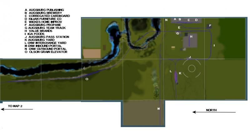
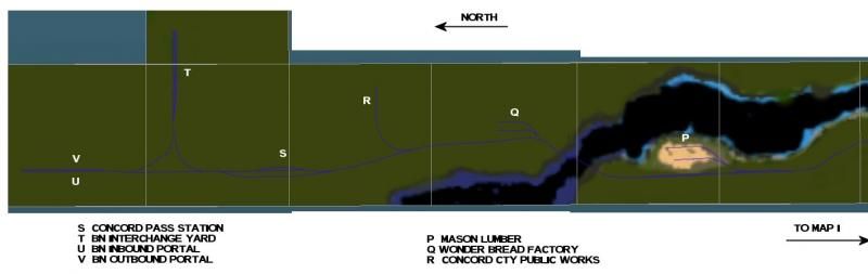
I know the mini map doesn't do justice to the route map, but I don't know how else to share this with others. BTW, the body of water is the Illinois River.
After a couple of driving sessions from one end to the other and back to make sure everything is connected; I will start planning the AI trains to complicate the sessions, a little bit. One thing I have to figure out is how to determine what assests are needed that aren't built in.
I know the mini map doesn't do justice to the route map, but I don't know how else to share this with others. BTW, the body of water is the Illinois River.