GMax and 3DSMax (And any other modeling program) screenies/renders

a4cb8eb7beada9432614f75dac0417dd.png


For a sick friend, get well soon buddy.
 
Doing a bit of a favor on the part of a certain pacific:
hudson_by_trainboi-d9qxx1z.jpg

Since I can't be bothered, most of these are ripped from my other models: the rods from the P10, and the lead bogey from some of my old Western projects. Nord-type tender bogey and Baldwin disc drivers are the only new pieces.
Eat your heart out Jackson. :p
 
Hi Guys, I'm looking to get some clear advice on the simplest and cheapest method, to take a map image from say, Google Earth and import it into TS12 or T:ANE.

I have already browsed through this thread and I see a number of people use different ways to achieve their goal. However, I'm not a computer 'Guru' in any way, so any complicated system is not going to help me.
I've seen prices for 3DsMax (which I understand is the latest program) but at $2,300 for a yearly sub, this is definitely out of the question!

Is there a basic step-by-step procedure available that I could use which would give good results? And what programs would I need?
OR,
Is there any source, who might prepare map files, which in turn, could be imported simply into Trainz?

These questions have probably been asked before, but I haven't been able to locate specific answers.

Cheers, Roy3b3
 
This may be what you need -
Hi Guys, I'm looking to get some clear advice on the simplest and cheapest method, to take a map image from say, Google Earth and import it into TS12 or T:ANE.

I have already browsed through this thread and I see a number of people use different ways to achieve their goal. However, I'm not a computer 'Guru' in any way, so any complicated system is not going to help me.
I've seen prices for 3DsMax (which I understand is the latest program) but at $2,300 for a yearly sub, this is definitely out of the question!

Is there a basic step-by-step procedure available that I could use which would give good results? And what programs would I need?
OR,
Is there any source, who might prepare map files, which in turn, could be imported simply into Trainz?

These questions have probably been asked before, but I haven't been able to locate specific answers.

Cheers, Roy3b3
 
If you are not a "guru," then you are like me, trying to learn the ropes. It can be confusing, with all of the options, so I wanted to make sure that when you are saying "Map Image," you are not also including elevation data in your question.

I broke down and purchased TranzDEM, and am glad I did if for no other reason than this outstanding tool provides the capability of combining the elevation modeling (DEM) with raster and vector (think basic routes) translated directly to baseboards that can be loaded into the Surveyor. It also works with Google Earth as well. I find it useful to combine maps from both Google Earth and USGS. I think that it was well worth the price, but I am still in the learning process with it. It certainly looks like a tool that will save a lot of time and aggravation.

A good point Joel, ... I know absolutely nothing about TransDEM, Blender, 3DSMax, or GMAX either,... but today that changed. I downloaded a 30-day Photoshop Trial + GMAX 1.2 and I'm now running through the tutorials to get some idea on how it all works. Once I can quickly upload a Google Earth Map into Surveyor, then I'll most probably look at TransDEM and take it a step further, because I would really like to use the 3D effect in mapping a few decent routes. I have a lot of unfinished routes in my stable and that's because I had big ideas for big routes and they never got done. Now I do prefer the smaller routes but putting some substance or a number of operating industries into them to make it more interesting. I've learnt a lot from the Russian and Polish guys as some of their routes are really good.
Good luck with TransDEM,... I'll be watching!
Cheers,
Roy
 
Blender, 3DSMax, and GMAX have nothing to do with making a Rout, they are for making a mesh as used in making a train car.
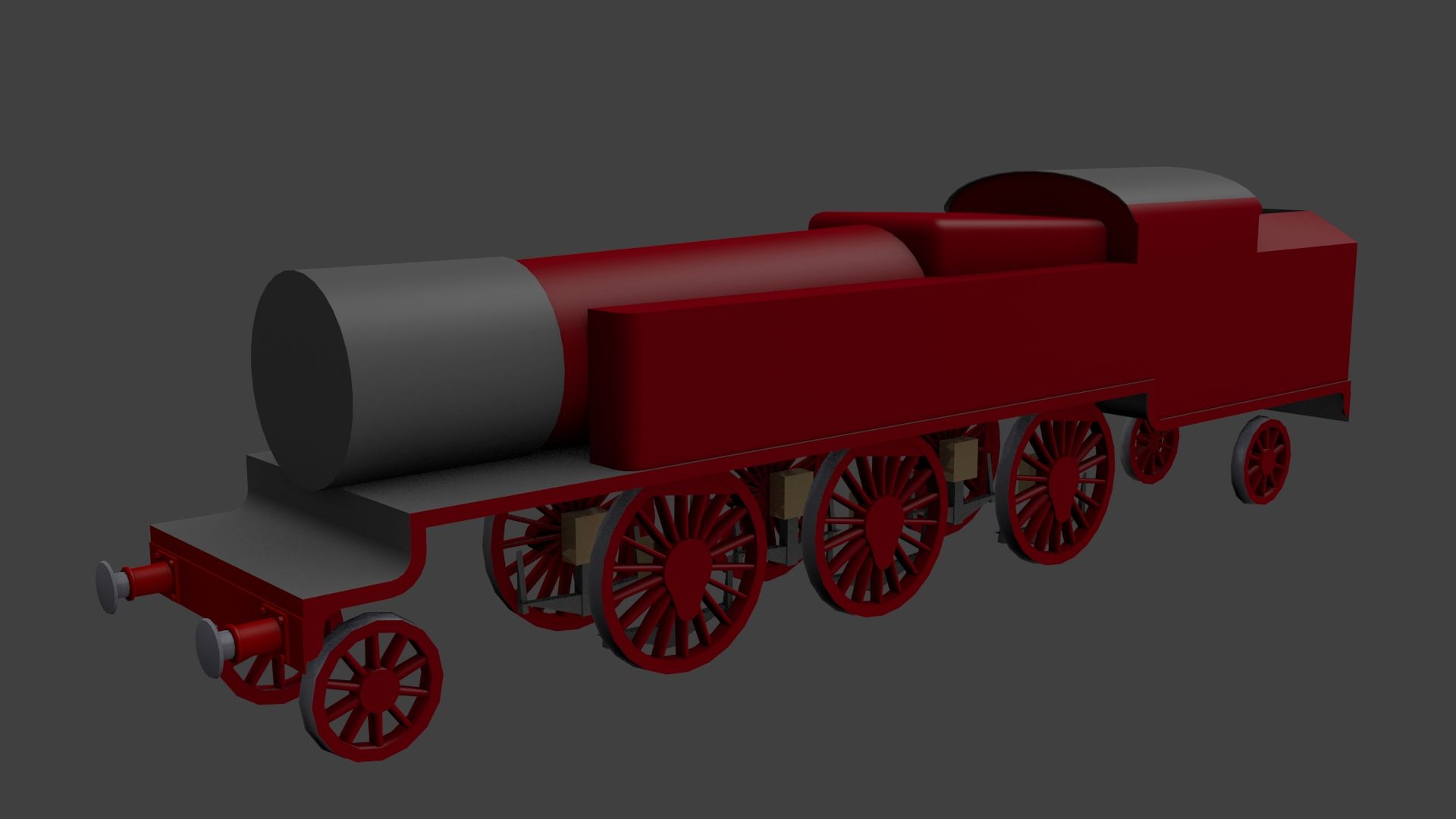
Well, thank you whitepass for informing me. I have been under the impression that these programs can assist in creating a 2D or 3D surface image file from a source, such as Google Earth which could be imported into Trainz and then onto a baseboard. From that baseboard image a route could eventually be created.

I understand that TransDEM is also used, but I wasn't sure if it required the use of the aforementioned programs as well. I wanted to familiarize myself with what the programs actually produced and whether I needed to go down that path first.
I don't have the skills or technique to create modelling assets, but what I am trying to achieve, is to create a contoured landscape directly onto a Trainz baseboard from a Google Earth map. From there I can create a better and more detailed route than I have done in the past. Do I need a combination of programs to achieve my goal?

I'd prefer to focus on what is actually required to do this, rather than fiddle around with programs that I may not even need. Your advice is appreciated, thank you.
Cheers,
Roy3b3
 
EDIT - @edh6: It's a Metropolitan Railway K class 2-6-4, isn't it. (I don't known why this didn't come to mind sooner!)
 
Last edited:
The start of something new, any guesses what it is? Hint: there is a wheelset missing.

My-Trainz-Screenshot-Image.jpg
That would be an LB&SCR L Class tank engine. Ok, I can't remember whether or not they were the L Class, but I do remember that only the LB&SCR had 4-6-4 tank engines painted in that color.
 
Back
Top